Showing posts with label Tower Bridge Road. Show all posts
Monday, 8 October 2012
Above Sarson's
A view made from above Sarson's Vinegar Works showing the vats in the left foreground and, in the middle distance to the left of the Sarson's chimney, you can see the wasteland that was White's Grounds, formerly known as Artillery Row. The building in the immediate foreground was a pub but, for the life of me, I can't remember its name.
This is a view of the buildings on the corner of Tanner St and Tower Bridge Road, where I made the 'high' view at the top of the page. I must have made the views of Sarson's from the roofs to the right of the right hand chimney stacks.
Saturday, 6 October 2012
The Printers Yard, GIFCO, Sarsons and Tyers Gate
![]() |
| A ground level view of the Printers Yard after the demolition of Bickels. Copyright Niall Connolly |
![]() |
| The rear elevation of the General Iron Foundry Company (GIFCO) building with the archway leading to Royal Oak Yard. Copyright Niall Connolly. |
![]() |
| High level view looking down into the Sarsons Vinegar Works from the east side of Tower Bridge Rd. Copyright Niall Connolly |
Melior Place, Tanner St and Elephant & Castle
![]() |
| Melior Place, 1984 |
![]() |
| During the demolition of the last functioning tannery, S O Rowe, at the junction of Tanner St and Tower Bridge Rd. Copyright Niall Connolly |
![]() |
| Another view of the S O Rowe site, looking north with the Sarson's chimney and vats just visible. Copyright Niall Connolly |
![]() |
| The Faraday Monument, Elephant & Castle. Copyright Niall Connolly |
Wednesday, 3 October 2012
St Mary Magdalene's Churchyard
Back in 2003, as a result of a phone call from a concerned member of the public, Southwark Council visited St Mary Magdalene's Churchyard and examined what lay behind a very fine hoarding at the northern boundary of the Churchyard.
The hoarding itself was perfectly legitimate, having been covered by an agreement between Southwark Council and the adjacent owner/developer. What wasn't quite so legitimate was what lay behind the hoarding.............................
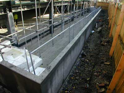
Behind the hoarding was a concrete terrace which was an extension, into the churchyard, from the adjacent development. The terrace was some 27m by 4m and extended downward by more than 2m. To construct this structure, an equivalent cubic amount of the churchyard had been removed and with that went what are known as 'disaggregated remains' ie skeletal remains of those buried in the churchyard in the years before the churchyard was deconsecrated. (As I understand it, the disturbance or removal of 'disaggregated remains' is a criminal offence.)
This was a good example of the conflict between development and public spaces, particularly when public spaces, such as churchyards and parks, no longer have the attention of staff who know their boundaries. Developers understand this.
Tuesday, 2 October 2012
The new millenium
![]() |
| A view of Tower Bridge Road during the demolition of the building adjacent to The Raven public house. Copyright Niall Connolly |
Sunday, 28 June 2009
Tower Bridge Road 1934
![]() |
| The triangular island at the junction of Tower Bridge Road and Grange Road, looking north. |
A close-up view of the notice-board in the centre of the image is available here. The notice-board reflects the then Bermondsey Borough Council's commitment to public health.
Subscribe to:
Posts (Atom)